Choosing the Right School
Where public charter school students live and go to school in 2016-2017
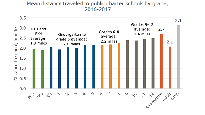
Distance to school by grade
Distance traveled to public charter schools increases as students get older, from a mean distance of 1.9 miles for pre-kindergarten 3 and pre-kindergarten 4 to a mean distance of 2.5 miles for high school students. Students traveling to alterative and adult schools travel close to the sector average of 2.1 miles.
Notes:
(1) Alternative students include students enrolled at schools that are eligible for DC PCSB’s Alternative Accountability Framework.
(2) Special Education students attending St. Coletta Special Education PCS may travel farther distances because students with higher levels of special education needs are more likely to be eligible for transportation services.
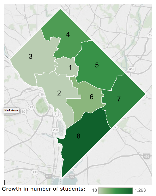
Growth by Ward where students live
In 2016-2017, students who live in Ward 8 accounted for most of the growth in public charter school enrollment. Enrollment of students who live in Wards 4, 5, and 7 grew as well.
Growth in where students live by Ward, change from 2015-2016 to 2016-2017
However, the distribution of public charter school students by where they live remains the same.
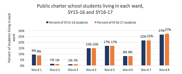
Note: All students with geocoded addresses are included (99% of students in SY16-17 and 96% of students in SY15-16).
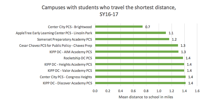
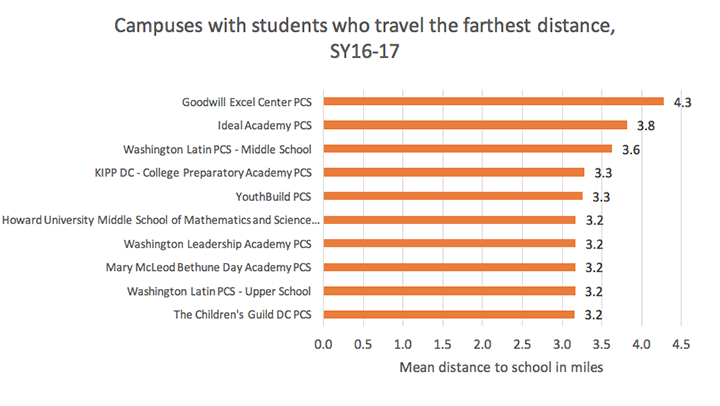
Distance to school by campus
Some public charter schools attract students who live in neighborhood, and other tend to enroll students from across the city. Sixteen public charter schools draw many students from their community with at least 30 percent of the students living within half a mile.
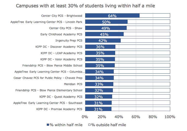
The public charter schools with students who travel the shortest distance tend to offer early grades or recruit students who live in the neighborhood.
Public charter schools with students who travel the farthest distance tend to offer adult education, high school grades, or highly demanded programs.
Hover over campuses on this map to find the distance traveled for any public charter school, and see the full report on distance to school and maps of where students live and go to school.
(1) DC PCSB calculated distance to school as the shortest distance between a student’s home and school (as the crow flies or geodetic distance), which does not account for actual walking or transportation distance. Consistent with previous years, DC PCSB used this methodology because students’ modes of transportation are unknown, which makes it impossible to calculate actual transportation distance (especially for students who arrive by Metrobus or Metrorail).
(2) Several public charter schools report enrollment for one campus but have more than one location. For these schools, distance to school was calculated as the distance between a student’s home and the midpoint of the campuses’ locations.